


Results 1 to 10 of 36
-
11th April 2022, 10:17 PM #1


 Garmin TOPO Switzerland V2 PRO
TOPO Switzerland V2 PRO
Garmin TOPO Switzerland V2 PRO
TOPO Switzerland V2 PRO
UnLocked IMGs
All credits to sandman123
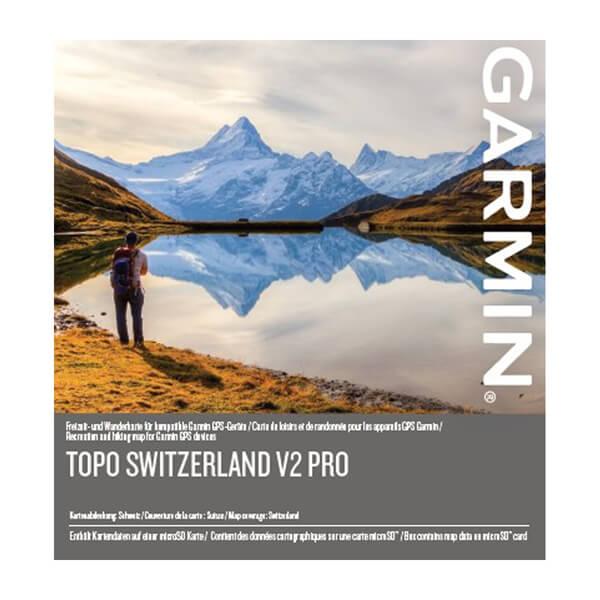
Overview
Make your holidays and recreational activities in Switzerland even more enjoyable with the first Garmin branded topographic map for the Swiss Confederation and Principality of Liechtenstein. With specific recreational maps for summer and winter, this topographic product surpasses any previously available mapping content, and is by far, the most updated and detailed map available for your Garmin outdoor handheld devices.
Feattures
- Covers the entire territories of Switzerland and Liechtenstein in 1 easy plug-and-play microSD™ card, with topographic data from the Federal Office of Topography swisstopo at a scale of 1:25,000
- Features ActiveRouting, which allows you to plan and customize routes using the entire road and trail network; the activity specific map display shows content in different colors for the various activities
- Popularity routing is available for devices supporting this feature
- Displays additional topographical raster maps at a scale of 1:25,000 from the Federal Office of Topography "swisstopo"
- Offers a special map layer for winter activities, such as ski tours, snowshoe tours and steep slopes
- Includes more than 750 “Named Trails” for hiking, tour cycling and mountain biking trails supplied by SwitzerlandMobility and the alpin huts by Cabanes Suisses
- Non-routable MTB transparent overlay with trail network provided by Singletrail
- Compatible with free BaseCamp™ software, that lets you plan trips on your computer, as well as transfer routes and waypoints from your computer to your compatible device.
Part Number: 010-12576-01
FID TOPO Switzerland v2 PRO: 8589
FID TOPO Switzerland v2 PRO Winter: 8590
Info:
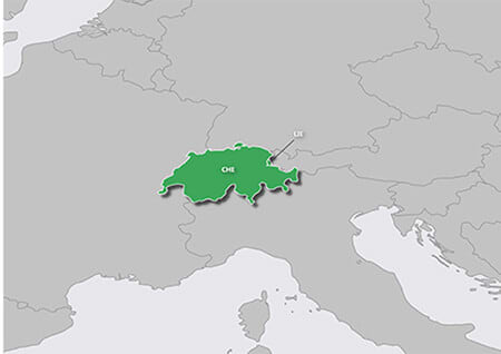
Coverage
Features topographic coverage for the entire territories of Switzerland and Liechtenstein.
TOPO Switzerland v2 PRO - Unlocked IMG
GMapTool Info:
04F7A9F473.7z (517 MB):
TOPO Switzerland v2 PRO WINTER - Unlocked IMG
GMapTool Info:
A7B5B64165.7z (562.3 MB):
TOPO Switzerland v2 PRO - MTB transparent overlay Unlocked IMG (Singletrail Map)
GMapTool Info:
67559E3696.7z (3.7 MB):
[down][/down]
TOPO Switzerland v2 PRO - SQL file (006-D6603-01.db)
40FA9CAA40.7z (5.7 MB):
TOPO Switzerland v2 PRO - JNX Birdseye Raster IMGs
F038CCE5A3.7z (2,95 GB):
Password for All Archives: 32JyYDftVv7oPHnFireFox58 Reviewed by FireFox58 on . Garmin TOPO Switzerland V2 PRO TOPO Switzerland V2 PRO UnLocked IMGs All credits to sandman123 https://res.garmin.com/en/products/010-D1536-01/g/cf-lg-91e1bf11-316a-4d85-baa0-b1c74ad0fa55.jpg https://res.garmin.com/en/products/010-D1536-01/g/cm-md-975000d3-0216-448a-a099-6e76fd3ae802.jpg Overview Make your holidays and recreational activities in Switzerland even more enjoyable with the first Garmin branded topographic map for the Swiss Confederation and Principality of Liechtenstein. With specific recreational maps Rating: 5
-
The Following 20 Users Say Thank You to FireFox58 For This Useful Post:
- [ Click To Expand ]
-
adamramzes (13th April 2022), AnnoyedOne (14th April 2022), betreuer (27th December 2022), bommelb (12th April 2022), Evgen501 (28th April 2022), flightofthenavi (22nd June 2023), freql (15th May 2022), Hyper (15th April 2023), javado (15th April 2022), khandarees (23rd June 2023), kilroy (12th April 2022), michelk (23rd April 2022), oiner (23rd August 2022), P i l o u (12th April 2022), rahvakunstnik (14th April 2022), Ratepenade (7th February 2023), ronand (12th April 2022), skinnie (12th April 2022), Smulan (14th April 2022), stef13m75 (4th October 2022)
-
13th April 2022, 02:20 PM #2

Hi @FireFox58,
On my Etrex 20, the jnx file cannot be read, the Gps says 'Invalid JNX file"
Kind regards,
Pilou
-
13th April 2022, 04:50 PM #3
Maybe your Device is Not capable to read a more than 3.0 GB JNX
We should try with a different Device
-
The Following 1 Users Say Thank You to FireFox58 For This Useful Post:
- [ Click To Expand ]
-
P i l o u (13th April 2022)
-
14th April 2022, 05:53 PM #4
I have the same issue with my gpsmap 66s. I think we must patch the firmware by the JNX loader firmware patcher v3.80. I will give it a try later on.
On the other hand: Basecamp also does not read the jnx-file from the device, so maybe something else is the reason (?)
Or we need a BirdsEye subscription (I don't have one).Last edited by bommelb; 14th April 2022 at 06:13 PM.
-
14th April 2022, 07:19 PM #5
Hi All,
The above JNX is really complicated ...
We were trying openining with a lot of sotware, without good news.
The only software capable of opening it seems to be Global Mapper
We are trying to reduce JNX Map in size ...

-
The Following 3 Users Say Thank You to FireFox58 For This Useful Post:
- [ Click To Expand ]
-
-
15th April 2022, 01:24 AM #6
I installed a new firmware on my gpsmap 66s with firmware v 9.90 already before patced for img and again also patched witch v 3.80 for JNX. That works for me.
It's a raster map and visible on my gpsmap 66s now.
So the 3,0 Gb is not an issue for me.Last edited by bommelb; 15th April 2022 at 01:34 AM.
-
20th April 2022, 04:21 PM #7
Did anybody checked the jnx file? How is the resolution compare to former raster img-files from v3 or 4?
I guess, the map now is more actual then the versions before?
Firefox, you made new raster maps from switzerland, since the data are free available. But the file size is really big...
-
20th April 2022, 11:33 PM #8
I didn't create anything, the JNX Map was shared by my friend sandman123.
This JNX is 1:25.000 scale, unlike the free ones available which are 1:50.000 scale.
We are "editing" the Map to obtain lighter and more usable JNX Maps.
The work is long and complex, I will let you know the developments
PS: When you share Links on other Forum, don't forget to give the right credits to my friend sandman123.
I have always done this, and I would like others to do it tooLast edited by FireFox58; 20th April 2022 at 11:40 PM.
-
The Following 3 Users Say Thank You to FireFox58 For This Useful Post:
- [ Click To Expand ]
-
Garmin_Nuvi (21st April 2022), kap55 (20th April 2022), Traveller66 (21st April 2022)
-
21st April 2022, 02:15 PM #9
You are right Firefox, I will do so next.
The older versions of the Swiss Topo Pro contains the 25k raster map in *.img format. The new one also should have by Garmin homepage. I guess the jnx-File shared by sandmann123 is comparable? Make it sense to transform the map in *.img format?
-
23rd April 2022, 09:58 PM #10

Is it the same version as Topo Suisse V3 and V4 in which there is the vector map in IMG format and the raster map in.
Why did you transform the raster map into JNX? On the V3 and V4 versions, the raster map displays very well on Basecamp and on the 66sr.
I tried to convert JNX file to IMG with JNX2IMG
the result is that the file is separated into two parts and missing tiles in the IMG files, probably it's too big because in principle it works, I've already created a lot of personal maps starting from JNX files and transformed into IMG and it's perfect.
As I can't do it I will use Mobac with the map of Switzerland which is up to date, by creating small files in RMAP or Oziexplorer then transforming them into JNX then into IMG.
two images of my JNX file from Geneva-Lausanne in zoom 16 with Mobac then with Mapc2mapc.
Swiss Topo V2 JNX file opens with JNXER 6.2 Beta see image below, But you can't do anything other than display the map and display its characteristics.:
Last edited by Garmin_Nuvi; 27th April 2022 at 03:16 AM. Reason: combined multiple consecutive posts. Please use edit. Removed link to another forum


 Register To Reply
Advertisements

Suggested Articles:


 Staff Online
Garmin Cyclops Safety Cameras -...
Garmin Cyclops Sept 20 AustraliaNewZealand...