


Results 241 to 250 of 254
-
30th July 2022, 11:59 PM #241

I was using MapSetToolKit.
Address search is working nicely btw.

-
31st July 2022, 12:53 AM #242


Last version of MapSetToolKit (v.1.77) is dated in 2010. It's an obsolete software
Maybe it works with this OSM based Maps, bat it will NOT work anyway with Garmin Original NT Maps (as City Navigator or TOPO Pro)
You are free to do and use what you want, but if you ask for isuues I answer with what I know

-
The Following 1 Users Say Thank You to FireFox58 For This Useful Post:
- [ Click To Expand ]
-
szabio (31st July 2022)
-
2nd August 2022, 11:12 PM #243
can we extract Turkey map from this set? if yes, which software shall we use? mapinstall or basecamp?
-
2nd August 2022, 11:21 PM #244
If you mean the Map object of discussion in the last Posts (Garmin Topo Active Europe 2021.20) I ask you to read what is written:
Officially the Map can NOT be divided, if you want to use the mentioned MapsetToolKit v.1.77 software you can do it but do not ask for support if it doesn't work for you
-
5th January 2023, 07:11 PM #245
 Garmin Topo Active PowerSports Europe 2022.10
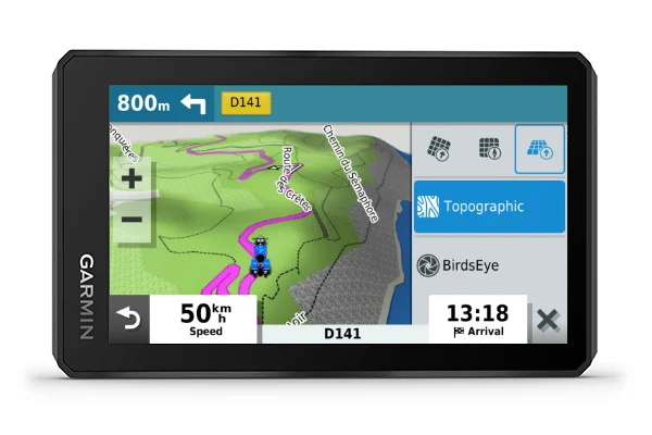
The zumo XT comes preloaded with TopoActive PowerSports maps for Europe, which are a little different than traditional Outdoor TopoActive Maps.
The Powersports color scheme emphasizes unpaved/dirt roads for offroad activities and is tailored to match the look and feel of the City Navigator maps
Feature colors are also optimized for use with the automotive map engine and zumo XT display
Since Powersports is tailored for the Automotive displays, it would not look good on Outdoor/Fitness devices
Coverage for the Powersports maps is exactly the same as standard TopoActive
Features included in TopoActive Maps:
TopoActive maps are not used for routing
International boundaries, waterways, natural features, land use areas, historical sites, airport structures, buildings, boundaries for national parks, national forests and more.
Contour or elevation lines are at roughly 100ft intervals
Contour line information varies based on location and detail the OpenStreetMap has for that area
Trail Coverage
Any trail, dirt road or road added to OpenStreetMap is added to the Garmin map
We do not limit which trails or roads we include
One advantage is the ability to interact with the map by adding trails or other relevant content which we can include in the next update
See the OpenStreetMap website for more info
Garmin Express is used for TopoActive map updates
These are updated periodically throughout the year, usually in the Spring and Fall
Includes topographic coverage of 47 countries in Europe: Albania, Germany, Andorra, Austria, Belarus, Belgium, Bosnia and Herzegovina, Bulgaria, Croatia, Cyprus, Denmark,
Spain, Estonia, Finland, France, Greece, Hungary, Ireland, Iceland, Italy, Kosovo, Latvia, Liechtenstein, Lithuania, Luxembourg, Macedonia, Malta, Moldova, Monaco,
Montenegro, Norway, Netherlands, Poland, Portugal, Czech Republic, Romania, United Kingdom, Russia (Kaliningrad only), San Marino , Serbia, Slovakia, Slovenia, Sweden,
Switzerland, Turkey, Ukraine and Vatican.
The quality of the coverage will depend on the region. Urban areas will typically be more developed while coverage in rural areas may not be very good. TopoActive Maps are a Garmin OpenStreetMap Product.
GARMIN TopoActive Powersports EU WEST
GMapTool Info:
Download Links (2.2Gb):
GARMIN TopoActive Powersports EU EAST
GMapTool Info:
Download Links (2.3Gb):
GARMIN TopoActive Powersports EU CENTRAL
GMapTool Info:
Download Links (2.3Gb):
Note:
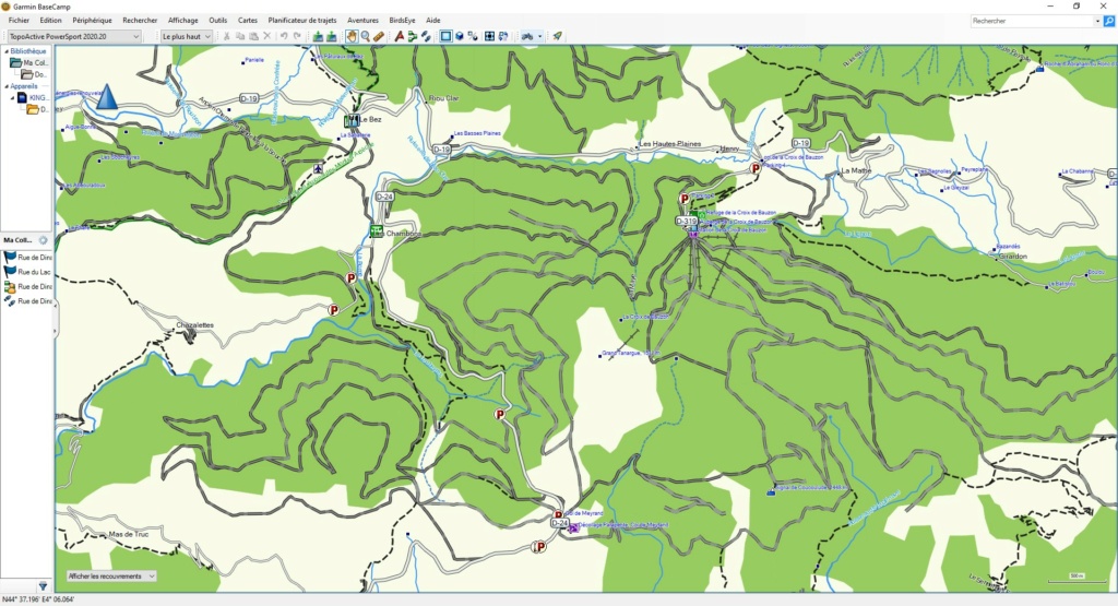
This is the original img file from a ZumoXT Gps.
Happy New Year all !Last edited by P i l o u; 9th January 2023 at 04:51 PM. Reason: Add Central Map
-
The Following 6 Users Say Thank You to P i l o u For This Useful Post:
- [ Click To Expand ]
-
adamramzes (5th January 2023), kap55 (6th January 2023), khandarees (5th January 2023), MikeEcho (26th August 2023), pppedrillo (6th January 2023), yh2005tw (9th January 2023)
-
15th April 2023, 10:58 PM #246
-
16th April 2023, 06:49 AM #247
Garmin Mod
Supporter
 Unless you are a "New" member, having used the Thanks button regularly is the quickest way to get help.
-
The Following 1 Users Say Thank You to Garmin_Nuvi For This Useful Post:
- [ Click To Expand ]
-
Hyper (16th April 2023)
-
3rd May 2023, 09:53 PM #248
Looking for US topo's
-
14th May 2023, 02:28 PM #249
-
14th May 2023, 04:38 PM #250


 Register To Reply
Advertisements

Suggested Articles:


 Staff Online
World/Europe Speedcams from SCDB
But this is a new invention of thieves. To steal,...