


Results 1 to 4 of 4
-
23rd July 2014, 02:08 AM #1
 Garmin Expert
Supporter

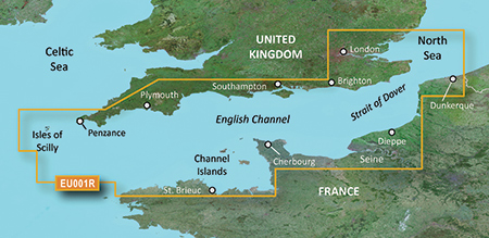
 BlueChart g2 Vision - VEU001R - English Channel 2015.5 (17.00)
BlueChart g2 Vision - VEU001R - English Channel 2015.5 (17.00)
See your vessels precise, on-chart position in relation to navaids, coastal features and restricted areas with premium features found in this detailed marine mapping data. Includes all of the features of our BlueChart® g2 product, plus 3-D perspective above and below the waterline, Auto Guidance, high-resolution imagery, and aerial photos of ports, harbors, marinas and landmarks.
- Shaded depth contours, coastlines, spot soundings, navaids, port plans, wrecks, obstructions, intertidal zones, restricted areas and IALA symbols.
- Seamless transitions between zoom levels and more continuity across chart boundaries.
- High resolution satellite imagery for a realistic view of the land and water.
- Aerial photos of ports, harbors, marinas, waterways, navigational landmarks and other POIs.
- Auto Guidance technology searches chart data to suggest the best passage to a destination.
- MarinerEye view 3-D perspective for a quick, easy position fix.
- FishEye view 3-D perspective for an underwater view of the sea floor.
- Safety Shading* enables contour shading for all depth contours shallower than your defined safe depths.
- Fishing Charts* to scope out bottom contours and depth soundings with less visual clutter on the display.
- Plan and organize routes from your computer with HomePort (sold separately).
Coverage
British coast: covers from Felixstowe to the Isles of Scilly, including Dover, The Solent, and the Isle of Wight. Also covers the River Thames from Twickenham to the North Sea. French coast: covers from Dunkerque to L'Aber Wrac'h, including Rouen and the Channel Islands
FID: 3849, PID: 1, RID: 2, VID: 8
Locked Image:
UnLocked Image:
 PiEtU Reviewed by PiEtU on . BlueChart g2 Vision - VEU001R - English Channel 2015.5 (17.00) BlueChart g2 Vision - VEU001R - English Channel 2015.5 (17.00) See your vessels precise, on-chart position in relation to navaids, coastal features and restricted areas with premium features found in this detailed marine mapping data. Includes all of the features of our BlueChart® g2 product, plus 3-D perspective above and below the waterline, Auto Guidance, high-resolution imagery, and aerial photos of ports, harbors, marinas and landmarks. Shaded depth contours, coastlines, spot Rating: 5
-
The Following 1 Users Say Thank You to PiEtU For This Useful Post:
- [ Click To Expand ]
-
sisalu88 (6th January 2015)
-
18th June 2017, 05:49 PM #2
link is dead ...
any other ?
thanks
-
3rd July 2017, 02:13 PM #3
I could do with this too
 can't find it anywhere else does anyone have fresh links?
-
25th March 2021, 03:38 AM #4

Re-uploaded this release
Enjoy.


 Register To Reply
Advertisements

Suggested Articles:


 Staff Online
2023.Q2 Here Australia,New Zealand
Australia New_Zealand HERE 2024.Q2 please